


Santo Antão - Hiking at the Edge of the World.
Santo Antão is the complete opposite of Sal: rugged, green, volcanically shaped - and for many, Cape Verde's most dramatic landscape. Steep, terraced valleys, hand-paved mountain roads, and one of West Africa's most spectacular hiking regions. One important fact upfront: there's no airport. If you come here, you come by ferry on purpose - and you're rewarded for it.
Santo Antão in 60 Seconds.
- No airport: the island is only reachable by ferry from Mindelo (São Vicente), a crossing of around 1 hour - the trip can be cancelled in rough seas, so build in a time buffer.
- The highlight: the terraced valleys of Ribeira Grande and Ribeira do Paúl, lined with sugarcane, coffee and bananas - one of West Africa's most spectacular hiking regions.
- Pure contrast: a dry, crater-like south around Porto Novo, a lushly green north - often experienced in a single day via the Corda mountain pass road.
- Grogue: locally distilled sugarcane spirit, traditionally made in small family distilleries in the northern valleys.
- Fitness required: the well-known trails are steep, sometimes exposed, and demand good footing - not a casual-stroll island.
Santo Antão at a Glance.
- Location
- Barlavento group, the northwesternmost island, across from São Vicente
- Main towns
- Porto Novo (ferry port & administration) · Ribeira Grande (north)
- Airport
- No airport - reachable only by ferry from Mindelo
- Language
- Portuguese (official) · Kriolu (everyday)
- Currency
- Cape Verdean Escudo (CVE), fixed to the euro: 1 € = 110.265 CVE
- Time zone
- UTC-1 (no daylight saving in Cape Verde)
- Power
- 220-230 V, plug types C/F
- Highest point
- ✓ Verified
Tope de Coroa, 1,979 m (Pico da Cruz, 1,585 m, is the best-known hiking peak, but only the fifth-highest mountain)
Who Is Santo Antão Right For?
Santo Antão is a hiking and nature island, not a beach island. An honest look before you book.
Great for...
- Hikers and trekking fans - one of West Africa's best hiking regions
- Landscape photographers: terraced valleys, volcanic rock, fog forest at higher elevations
- Anyone seeking quiet and authenticity, away from resorts and nightlife
- Independent travelers with some time and flexibility - the ferry makes last-minute plans harder
- Grogue and slow-food enthusiasts: small family distilleries, local farming
Less suited for...
- Pure beach holidaymakers - notable sandy beaches are almost entirely absent; the coast is mostly rocky
- Anyone who wants to plan with certainty - the ferry can be cancelled in rough seas, so a time buffer is essential
- Travelers with mobility impairments - the main attractions sit along steep, sometimes exposed trails
- Anyone expecting lots of hotel choice and nightlife - the infrastructure is simple and limited
When's the Best Time to Visit?
Santo Antão has a noticeably wetter, cooler climate than the eastern islands - the mountains capture trade-wind clouds, especially in the green north.
Santo Antão is the wettest island in the archipelago - the windward northern valleys like Ribeira Grande and Ribeira do Paúl especially benefit from trade-wind clouds that pile up against the mountains. Higher elevations can be noticeably cooler than the coast even during the day, dropping below 15°C at night in places. November to June is considered the best time for hiking, when the trails are dry and in good condition.
Two Climate Zones in One Day
Drive north from Porto Novo over the Corda mountain pass and you'll often experience both extremes in a single morning: dry, barren south - and a few kilometers later, dense fog or cloud over the green valleys. A wind and rain jacket belongs in your day bag even on a sunny start.
The Valleys of Santo Antão.
Ribeira Grande
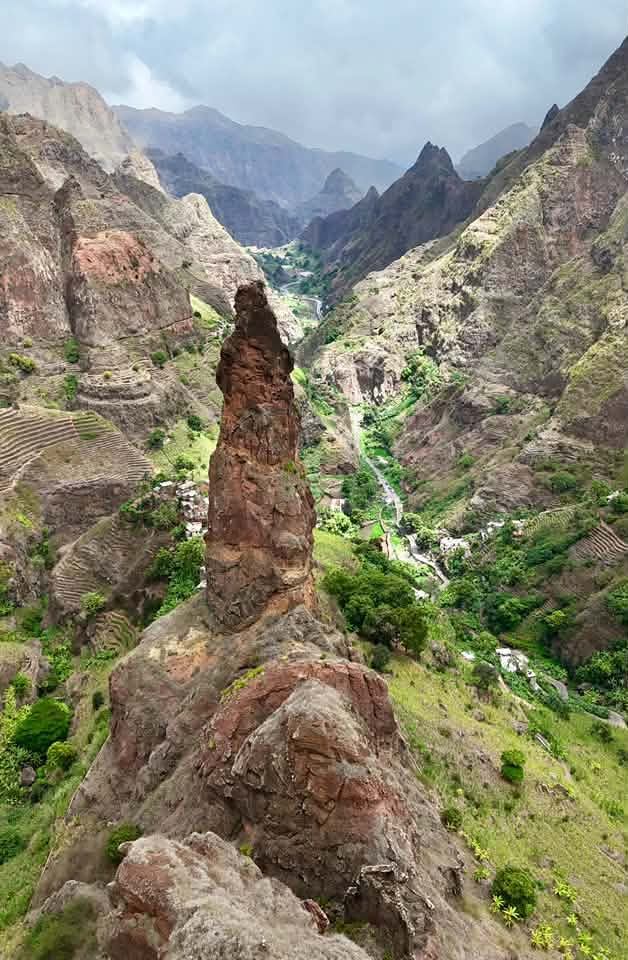
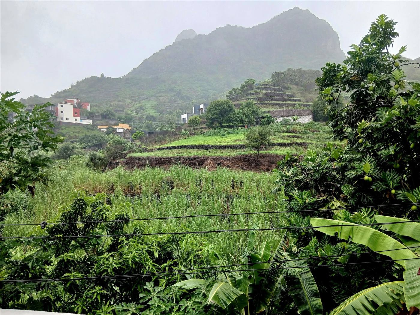
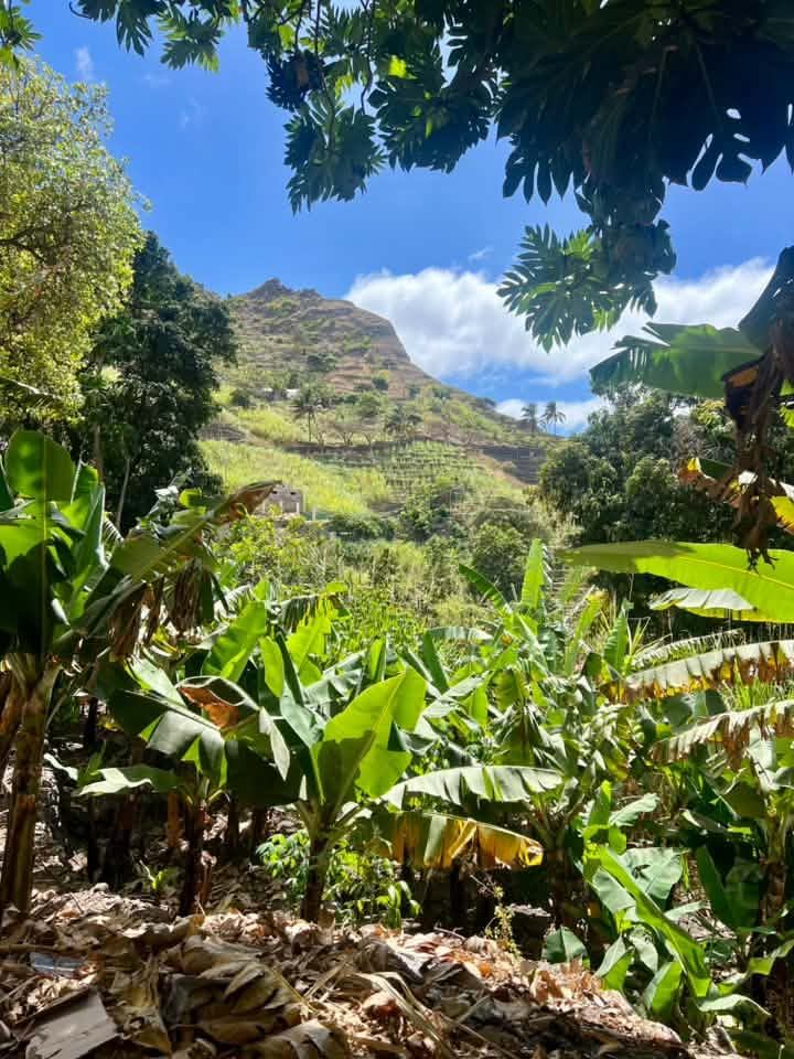
The island's best-known and most-photographed valley: steep, terraced slopes with sugarcane, bananas and coffee, crossed by the spectacular mountain road between Ponta do Sol and Cha de Igreja. Numerous trails follow old irrigation channels (levadas) through the valley.
Ribeira do Paúl
Another, similarly spectacular valley southeast of Ribeira Grande - narrower and in places even greener, with terraced cultivation stretching far up the slopes. The climb from Vila das Pombas up through the terraces to the mountain village of Cova ranks among the island's best-known hikes.
Cova (Crater)
An extinct, lushly green volcanic caldera at the island's heart, around 1,100 m up - surprisingly fertile farmland inside the crater rim, surrounded by rugged walls. The starting point for several popular hiking routes down to Ribeira da Torre or Ribeira do Paúl.
Fontainhas
A small mountain village on a dramatically steep rocky ridge overlooking Ribeira Grande - one of the island's most-photographed postcard views. A handful of houses, a small café, but a panorama that rewards the steep climb (or the winding drive).
Corda Mountain Pass Road
The mountain road connecting the dry south around Porto Novo with the green north - at over 1,500 m, often wrapped in clouds, with spectacular views over both sides of the island on a clear day.
Grogue Distilleries
In the northern valleys, small family businesses have been distilling Grogue from their own sugarcane for generations, often still using ox- or engine-driven presses. Several distilleries in and around Ribeira Grande can be visited as part of a tour.
Tarrafal de Monte Trigo
The isolated retreat in the island's southwest - one of the few places on Santo Antão with a genuine, quiet sandy beach. Since the access road was paved in 2021, the drive from Porto Novo takes only about an hour instead of the previous multi-hour off-road trip; only the final stretch across the beach into the village remains unpaved. A fishing and farming village with noticeably more quiet than the hiking-driven north.
Photogenic Spots
Fontainhas looks most impressive in the early morning light, before clouds gather over the mountains. The terraced fields in Ribeira do Paúl look most sculptural in the late-afternoon side light. On the Corda mountain pass, it's worth planning for several days to get good visibility - fog can wipe out the view entirely at short notice.
Three Towns, Three Faces.
Porto Novo, Ribeira Grande and Ponta do Sol show three very different sides of the island.
Porto Novo
The main town in the dry south and the ferry's arrival point from Mindelo - the island's administrative seat, but more of a waypoint than a destination for travelers. From here, the Corda mountain pass road leads up and on into the green north.
Ribeira Grande (Town)
The namesake of the valley and the tourist center in the north, with the widest choice of accommodation and guides. The starting point for most of the well-known hikes and Grogue tours.
Ponta do Sol
The island's northernmost town, on the coast at the end of the Ribeira Grande mountain road - a small fishing village with a lighthouse and one of the few spots where the hiking valleys meet the Atlantic directly.
What to Experience on Santo Antão.
Hiking (Levada & Mountain Trails)
The heart of any Santo Antão visit: marked and unmarked trails along old irrigation channels through Ribeira Grande and Ribeira do Paúl, plus more demanding mountain routes around Cova and Pico da Cruz. A local guide noticeably increases both safety and the experience - many trails are narrow and exposed.
Driving the Corda Mountain Pass Road
By rental car, taxi or Aluguer along the winding mountain road between Porto Novo and Ribeira Grande - one of Cape Verde's most spectacular drives, whether or not you hike yourself.
Grogue Tasting
A visit to a family distillery in Ribeira Grande, often combined with a tasting of Grogue and the Ponche made from it (with honey and spices). Usually arranged informally on the spot, no fixed ticket system.
Mountain Hike to Pico da Cruz
A more demanding route to the island's best-known hiking peak (ca. 1,585 m) - a panoramic view over much of the archipelago in clear weather, though it's often wrapped in clouds.
Coastal Hike: Ponta do Sol - Cruzinha da Garça
Around 15 km and about 6 hours along steep basalt cliffs above the Atlantic, past Fontainhas and the famous switchbacks of the Bordeira de Norte to the volcanic-sand beach of Praia da Ribeira Seca and the fishing village of Cruzinha da Garça - one of Cape Verde's most spectacular coastal trails, demanding and unsuitable for anyone with a fear of heights.
Photography & Village Life
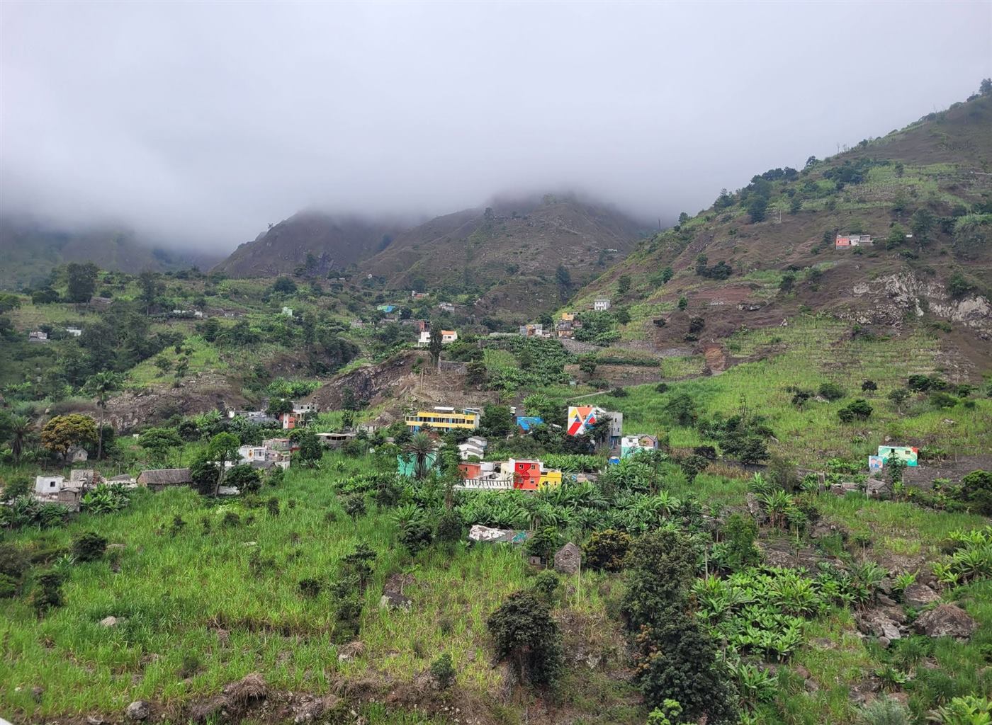
Fontainhas, the terraced fields, and the unhurried daily life in the valleys offer plenty of subjects beyond the trails themselves - one reason many travelers spend more time here than planned.
Boat Trips From Porto Novo
Occasional boat and fishing trips along the coast, a much smaller offering than on the beach islands - more a complement to the hiking program than the main reason for a visit.
Insider Tip: A Local Guide Instead of Solo Trekking
◐ Community valueSome levada trails are narrow, exposed and not continuously signposted - in fog or after rain, finding your way can get tricky. A local guide knows not just the safe route, but also informal shortcuts, viewpoints and the right Grogue stops along the way. For the well-known classics (Ribeira Grande, Ribeira do Paúl, Cova), booking one is still worthwhile even if you're in good shape yourself.
How Much Time to Plan for Santo Antão?
Three example rhythms for orientation - not a rigid plan, but a template to adapt.
Short Trip From Mindelo
- Day 1: Early ferry from Mindelo, drive over the Corda mountain pass to Ribeira Grande
- Day 2: Full-day hike in Ribeira do Paúl or Ribeira Grande with a guide
- Day 3: Fontainhas & a Grogue distillery, return ferry in the afternoon
Classic Hiking Trip
- Day 1: Arrival in Porto Novo, drive north
- Day 2: Ribeira Grande hike, levada trails
- Day 3: Cova crater down to Ribeira do Paúl (guide recommended)
- Day 4: Fontainhas, Grogue distilleries, Ponta do Sol
- Day 5: Mountain hike toward Pico da Cruz or a rest day
- Day 6: Drive back over the Corda mountain pass, return ferry to Mindelo
Combine With Island Hopping
- Week 1: Santo Antão as above - deliberately build in the island's slower travel pace
- Week 2: Ferry back to Mindelo (São Vicente) for culture, music and city flair - one of the most straightforward island combinations in Cape Verde
Arriving & Getting Around.
What actually matters after the ferry arrives - cash, SIM card and getting around the island.
Ferry Instead of Airport
Since Santo Antão has no airport, the only way in is the ferry operated by CV Interilhas from Mindelo (São Vicente), a crossing of around 1 hour. This short Barlavento route is considered one of the most reliable ferry connections in the whole archipelago, with daily departures - far less prone to cancellation than longer routes. In very rough seas (mainly November to March), the crossing can still be cancelled on short notice; if you have a return flight from Sal or Praia, build in a time buffer. Since Santo Antão has no international airport of its own, the EASE registration is already due for your actual arrival airport (usually São Vicente), not here on the ground.
Aluguer (Shared Taxis) & Hop-On-Hop-Off Hiking
Shared taxis connect Porto Novo with Ribeira Grande over the Corda mountain pass, usually as "Hiace" minibuses. They run on a fill-up-and-go basis, departing only once all seats are taken - fixed, low per-seat prices, but no fixed departure times. If you don't want to wait, you can charter the whole vehicle privately instead - pricier, but an immediate departure and your own photo stops. Popular with hikers: start at one point, get driven to the trailhead, and get picked up again at the finish - many local guides offer this directly.
Money & ATMs
ATMs exist in Porto Novo and Ribeira Grande; smaller valleys and villages usually have none. Withdraw enough cash before heading north - cards with Maestro/Cirrus work more reliably than V-Pay.
SIM Card & Network Coverage
Alou and Unitel T+ both have coverage in Porto Novo and Ribeira Grande. In the deep valleys and on remote trails, network coverage is patchy - for emergencies, let your guide contact and accommodation know your plans in advance rather than relying on continuous signal.
Rental Car & the Corda Mountain Pass Road
A rental car (ideally with some switchback experience) opens up the island flexibly; the Corda mountain pass road is well-maintained but winding and sometimes wrapped in clouds. Driving is on the right, as in most of Europe; an International Driving Permit alongside your national licence is recommended by most foreign offices.
Tipping & Etiquette
There's no fixed tipping system. For hiking guides, voluntary tips are common and an important part of their income - travelers often mention a few hundred escudos per tour as a rough guide, depending on group size and tour length.
Unlike the Eastern Islands: Real Water Here
Unlike Sal or Boa Vista, Santo Antão's mountains give it natural springs and streams in the valleys - the farming in Ribeira Grande and Ribeira do Paúl depends on exactly that. Even so: tap water generally isn't recommended as drinking water; bottled or boiled water is the safer choice on the go.
Cape Verde Has a Single-Use Plastic Ban
Since 22 March 2024, marketing single-use plastic bags, cups and cutlery has been banned nationwide by law. If you're hiking through the valleys, make a habit of carrying your own trash back out - there's no regular garbage collection in the remote valleys anyway, and litter in the terraced landscape is an especially visible no-go.
What You Should Watch Out For.
General Safety
Santo Antão is considered one of the safest and quietest islands in Cape Verde - the biggest practical danger isn't crime, but terrain: steep, sometimes exposed trails that get slippery when wet. Ordinary caution is enough. Check your own country's current travel advisories before departure.
Health & Fitness
Fitness for hiking matters more than classic travel vaccinations: sturdy, broken-in hiking boots, enough water, and a realistic self-assessment of your own fitness are essential. The usual travel vaccinations (including tetanus/diphtheria, hepatitis A) are still recommended - consult a doctor before your trip. Cape Verde has been officially malaria-free since January 2024. In 2023/2024 there was a nationwide dengue outbreak (around 19,000 cases, 8 deaths, declared over in January 2025) - initially centered on Fogo, but shifting clearly to the capital Praia on Santiago as the year went on; treat this as general, nationwide Cape Verde information.
Medical Care
Basic care is available through small health centers in Porto Novo and Ribeira Grande. For more serious cases or emergencies out in the terrain, care is noticeably slower than on the airport islands - international health insurance with repatriation cover is especially important here, as is a communicated emergency plan before any more demanding hike.
Emergency Numbers
Police 132 · Fire Brigade 131 · Ambulance 130. According to several international travel sources, these are also reachable without a SIM card (we couldn't find an official confirmation that calls are free of charge) - save them to your phone right on arrival, since signal on remote trails is often weak.
Where to Stay?
Deliberately without invented individual prices: prices change constantly by season and provider. These three categories help you get oriented - check current prices via the booking links below.
Budget
Casas de Hóspedes- Simple family guesthouses in Ribeira Grande and Porto Novo
- Often with half-board - local cooking right in the house
- Personal contact, often a good starting point for guide referrals
Mid-range
Small hotels & aparthotels- Mainly around Ribeira Grande and Ponta do Sol
- Usually with breakfast, some with mountain views
- A limited selection - book early in high season
Premium
Boutique accommodation- A handful of high-quality properties with valley or mountain views
- No classic resort offering like on Sal or Boa Vista
- Mostly small, individually run houses rather than chains
Check current prices and availability for all three categories directly with each provider.
What Does a Week on Santo Antão Cost?
€ Price guideBallpark figures per person and week on the ground (excluding flights/ferry), highly dependent on season and style - for rough orientation, not an exact quote.
| Category | Budget | Mid-range | Comfortable |
|---|---|---|---|
| Accommodation | Simple Casa de Hóspedes | Small hotel, central | Boutique accommodation with a view |
| Food | Local cuisine, half-board | Mix of restaurants & guesthouse | Upscale restaurants, where available |
| Local transport | Aluguer (shared taxi) | Taxi & occasional rental car | Rental car throughout / private driver |
| Activities | Independent hiking | 2-3 guided hikes | Daily guided tours |
Planning More Than Just Hiking?
Island hopping, digital nomad life, or an interest in nature - three topics that go beyond simple hiking planning.
Combining With São Vicente
Santo Antão and São Vicente are practically a pair, linked by the short ferry - culture and nightlife in Mindelo, hiking and quiet on Santo Antão. One of the most straightforward island combinations in Cape Verde.
Flights & Island Hopping →Digital Nomad on Santo Antão
Noticeably quieter and slower than Sal or Mindelo - realistically more suited to a hiking retreat than long-term remote work, since internet and infrastructure in the valleys are noticeably thinner.
Digital Nomads Guide →Nature Interest & Endemism
Santo Antão's higher elevations are home to some of Cape Verde's most species-rich natural areas, with endemic plants in the damper zones around Cova and Tope de Coroa.
Cape Verde Fauna & Flora →How Do You Get to Santo Antão?
There's no airport - every route runs via São Vicente first.
From Mindelo (São Vicente)
⚠ Subject to changeFirst, fly (usually via Sal or Praia) to São Vicente, then take the ferry from Mindelo to Porto Novo - a crossing of around 1 hour. Several crossings a day are typical, but schedules do change and should be checked directly with the operator before you travel - current departure times and operator links are in our Ferry Guide.
Cancellation Risk in Rough Seas
In heavy swell, the crossing can be cancelled or postponed on short notice - especially in the windier months. If you have a connecting flight, plan at least one full buffer day between the return ferry and continuing your journey.
What Actually Helps on Santo Antão.
Not a generic travel packing list, but what makes a real difference specifically on Santo Antão.
- Sturdy, broken-in hiking boots with good grip - the single most important piece of gear
- A wind and rain jacket, even on a sunny start - mountain weather changes fast
- Trekking poles for steep ascents and descents, especially when wet
- Enough cash in escudos - ATMs exist only in the larger towns
- A small power bank - outlets aren't a given everywhere in simple accommodation
- Your national driving licence, plus an International Driving Permit if renting a car
- A time buffer in your itinerary in case the ferry is cancelled due to rough seas
- Bottled or boiled drinking water for the trail, even though the island itself has more water than Sal or Boa Vista
Sources & Page Status
- Highest point corrected: this page previously, incorrectly, named Pico da Cruz (1,585 m) as the island's highest point. Per Wikipedia/PeakVisor, the actual highest point is Tope de Coroa (1,979 m) in the island's west - Pico da Cruz is only the fifth-highest mountain, but the best-known and most-climbed hiking peak. Pico da Cruz's own elevation (1,585 m) was already correct.
- Area ca. 779 km²: close to the English Wikipedia figure (785 km²) - normal source variance.
- Population 36,632 (2021 Census, INE Cabo Verde): independently cross-checked (geo-ref.net, a table with RGPH-2021 data by island) - corrected from a previously too-high estimated range around 40,000 (an average of a 2019 estimate of 38,200 and the 2010 census figure of ~43,000), for which no island-specific 2021 figure was found at the time.
- "Wettest island": confirmed via Wikipedia/geographic sources - roughly 475 mm of annual rainfall in the north (noticeably more at windward elevations), compared to only about 230 mm in Praia/Santiago and even less on the eastern islands.
- Safety & Health section expanded: this page already had its own Safety & Health section, but without a dengue note or emergency numbers - both added to match the sitewide standard (the 2023/2024 dengue outbreak with the already sitewide-corrected Fogo→Santiago shift, emergency numbers 132/131/130).
- Single-use plastic ban date corrected: the page previously, incorrectly, said "May 2024" - per the official Boletim Oficial, the law (based on Law 22/X/2023) took effect on 22 March 2024.
How Our Members See It.
Questions About Santo Antão.
How do you get to Santo Antão without an airport?
Via São Vicente: a flight (usually via Sal or Praia) to Mindelo, then the ferry to Porto Novo, a crossing of around 1 hour. Check schedules before you travel, since they can change.
Can the ferry be cancelled?
Yes, in very rough seas (mainly November to March) the crossing can be cancelled on short notice. The short Mindelo-Porto Novo route run by CV Interilhas is considered one of the most reliable ferry connections in Cape Verde, but anyone with a connecting flight should still build in a buffer day.
Do you need a guide for the hikes?
Not strictly necessary for the well-known classics like Ribeira Grande or Ribeira do Paúl, but recommended - many trails are narrow, exposed and not continuously signposted, especially in fog or after rain.
Are there beaches on Santo Antão?
Notable sandy beaches are almost entirely absent - the coast is mostly rocky. Santo Antão is a hiking island, not a beach island; Sal or Boa Vista are much better suited to beach holidays.
How many days should you plan for Santo Antão?
3-4 days is enough for the main valleys and hikes; for a relaxed hiking program with several routes, plan for more like 5-6 days or more.
How difficult are the hiking trails on Santo Antão?
It varies: easier levada trails along the irrigation channels are manageable for most people, while routes like Pico da Cruz or around the Cova crater rim are more demanding and require good footing and fitness.
What is Grogue?
A locally distilled sugarcane spirit, traditionally made in small family distilleries in the northern valleys - several distilleries around Ribeira Grande can be visited.
Is it worth combining with São Vicente?
Yes, the short ferry makes Santo Antão and São Vicente one of the most straightforward island combinations in Cape Verde - hiking and quiet here, culture and nightlife in Mindelo.
Is there an actual sandy beach on Santo Antão?
Yes, Tarrafal de Monte Trigo in the southwest - reachable in about an hour from Porto Novo since the access road was paved in 2021. The final stretch across the beach into the village remains unpaved.
Do I have to carry out my trash while hiking?
Yes, absolutely - there's no regular garbage collection in the remote valleys. Cape Verde has also had a nationwide single-use plastic ban since 22 March 2024.
Ready for Santo Antão?
Compare current prices for flights, ferries and accommodation, or take a look at the other 8 islands first before deciding.